Air Traffic Control technology and systems
Approach, how far from the airport are we in minutes? N923, the faster you go, the quicker you'll get here.
- ORD ATC.
Technology
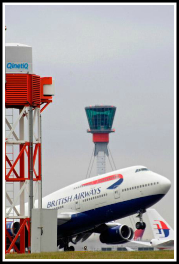
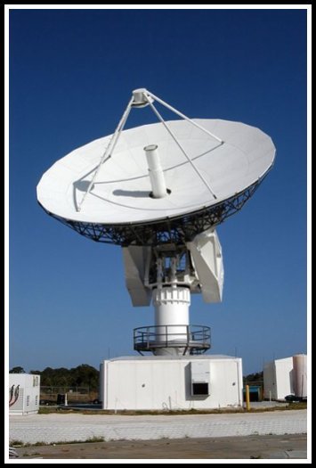
Many technologies are used in air traffic control systems. Primary and secondary radar are used to enhance a controller's situation awareness within his assigned airspace - all types of aircraft send back primary echoes of varying sizes to controllers' screens as radar energy is bounced off their skins, and transponder-equipped aircraft reply to secondary radar interrogations by giving an ID (Mode A), an altitude (Mode C) and/or a unique call-sign (Mode S). Certain types of weather may also register on the radar screen.
These inputs, added to data from other radars, are correlated to build the air situation. Some basic processing occurs on the radar tracks, such as calculating ground speed and magnetic headings.
Usually, a Flight Data Processing System manages all the flight plan related data, incorporating - in a low or high degree - the information of the track once the correlation between them (flight plan and track) is established. All this information is distributed to modern operational display systems, making it available to controllers.
The FAA has spent over US$3 billion on software, but a fully automated system is still over the horizon. In 2002 the UK brought a new area control centre into service at the London Area Control Centre, Swanwick, in Hampshire, relieving a busy suburban centre at West Drayton, Middlesex, north of London Heathrow Airport. Software from Lockheed-Martin predominates at the London Area Control Centre. However, the center was initially troubled by software and communications problems causing delays and occasional shutdowns.
Some tools are available in different domains to help the controller further:
Flight Data Processing Systems: this is the system (usually one per Center) that processes all the information related to the Flight (the Flight Plan), typically in the time horizon from Gate to Gate (airport departure/arrival gates). It uses such processed information to invoke other Flight Plan related tools (such as e.g. MTCD), and distributes such processed information to all the stakeholders (Air Traffic Controllers, collateral Centers, Airports, etc.)
Short Term Conflict Alert (STCA) that checks possible conflicting trajectories in a time horizon of about 2 or 3 minutes (or even less in approach context - 35 seconds in the French Roissy and Orly approach centres) and alerts the controller prior to the loss of separation. The algorithms used may also provide in some systems a possible vectoring solution, that is, the manner in which to turn, descend, or climb the aircraft in order to avoid infringing the minimum safety distance or altitude clearance
Minimum Safe Altitude Warning (MSAW): a tool that alerts the controller if an aircraft appears to be flying too low to the ground or will impact terrain based on its current altitude and heading
System Coordination (SYSCO) to enable controller to negotiate the release of flights from one sector to another
Area Penetration Warning (APW) to inform a controller that a flight will penetrate a restricted area
Arrival and Departure Manager to help sequence the takeoff and landing of aircraft
- The Departure Manager (DMAN): A system aid for the ATC at airports, that calculates a planned departure flow with the goal to maintain an optimal throughput at the runway, reduce queuing at holding point and distribute the information to various stakeholders at the airport (i.e. the airline, ground handling and Air Traffic Control (ATC))
- The Arrival Manager (AMAN): A system aid for the ATC at airports, that calculates a planned arrival flow with the goal to maintain an optimal throughput at the runway, reduce arrival queuing and distribute the information to various stakeholders
- passive Final Approach Spacing Tool (pFAST), a CTAS tool, provides runway assignment and sequence number advisories to terminal controllers to improve the arrival rate at congested airports. pFAST was deployed and operational at five US TRACONs before being cancelled. NASA research included an Active FAST capability that also provided vector and speed advisories to implement the runway and sequence advisories
Converging Runway Display Aid (CRDA) enables approach controllers to run two final approaches that intersect and make sure that go arounds are minimized
Center TRACON Automation System (CTAS) is a suite of human centered decision support tools developed by NASA Ames Research Center. Several of the CTAS tools have been field tested and transitioned to the FAA for operational evaluation and use. Some of the CTAS tools are: Traffic Management Advisor (TMA), passive Final Approach Spacing Tool (pFAST), Collaborative Arrival Planning (CAP), Direct-To (D2), En Route Descent Advisor (EDA) and Multi Center TMA. The software is running on linux
Traffic Management Advisor (TMA), a CTAS tool, is an en route decision support tool that automates time based metering solutions to provide an upper limit of aircraft to a TRACON from the Center over a set period of time. Schedules are determined that will not exceed the specified arrival rate and controllers use the scheduled times to provide the appropriate delay to arrivals while in the en route domain. This results in an overall reduction in en route delays and also moves the delays to more efficient airspace (higher altitudes) than occur if holding near the TRACON boundary is required to not overload the TRACON controllers. TMA is operational at most en route air route traffic control centers (ARTCCs) and continues to be enhanced to address more complex traffic situations (e.g. Adjacent Center Metering (ACM) and En Route Departure Capability (EDC))
MTCD and URET
- in the US, User Request Evaluation Tool (URET) takes paper strips out of the equation for En Route controllers at ARTCCs by providing a display that shows all aircraft that are either in or currently routed into the sector
- in Europe, several MTCD tools are available: iFACTS (NATS), VAFORIT (DFS), New FDPS (MASUAC). The SESAR Programme should soon launch new MTCD concepts
URET and MTCD provide conflict advisories up to 30 minutes in advance and have a suite of assistance tools that assist in evaluating resolution options and pilot requests.
Mode S: provides a data downlink of flight parameters via Secondary Surveillance Radars allowing radar processing systems and therefore controllers to see various data on a flight, including airframe unique id (24-bits encoded), indicated airspeed and flight director selected level, amongst others
CPDLC: Controller Pilot Data Link Communications - allows digital messages to be sent between controllers and pilots, avoiding the need to use radiotelephony. It is especially useful in areas where difficult-to-use HF radiotelephony was previously used for communication with aircraft, e.g. oceans. This is currently in use in various parts of the world including the Atlantic and Pacific oceans
ADS-B: Automatic Dependent Surveillance Broadcast - provides a data downlink of various flight parameters to air traffic control systems via the Transponder (1090 MHz) and reception of those data by other aircraft in the vicinity. The most important is the aircraft's latitude, longitude and level: such data can be utilized to create a radar-like display of aircraft for controllers and thus allows a form of pseudo-radar control to be done in areas where the installation of radar is either prohibitive on the grounds of low traffic levels, or technically not feasible (e.g. oceans). This is currently in use in Australia, Canada and parts of the Pacific Ocean and Alaska
The Electronic Flight Strip system (e-strip): A system of electronic flight strips replacing the old paper strips is being used by several Service Providers, such as NAV CANADA, MASUAC, DFS, being produced by several industries, such as NAVCANatm, Indra Sistemas, Thales Group, Frequentis, Avibit, SAAB etc. E-strips allows controllers to manage electronic flight data online without Paper Strips, reducing the need for manual functions. This first electronic flight strips system was invented and implemented by NAV CANADA in 1999, then known as EXCDS and rebranded in 2011 to NAVCANstrips
Screen Content Recording: Hardware or software based recording function which is part of most modern Automation System and that captures the screen content shown to of the ATCO. Such recordings are used for a later replay together with audio recording for investigations and post event analysis
Communication Navigation Surveillance/Air Traffic Management (CNS/ATM) systems are communications, navigation, and surveillance systems, employing digital technologies, including satellite systems together with various levels of automation, applied in support of a seamless global air traffic management system
UTC | Zulu Time
Copyright © 2012 Roger. All rights reserved. | Sitemap